Doctor nearby Pusat Perubatan Islam
Malaysia
Doctor nearby Pusat Perubatan Islam
Pusat Perubatan Islam
Kampung Tadok, Segamat Malaysia
contacts phone
:
+60
Latitude:
2.59175
, Longitude:
102.8160061
read more
nearest Doctor
1.712 km
Pusat Perubatan Islam
Jalan Gelang Chinchin, Segamat
Doctor
read more
5.972 km
9W2UMA - Amateur Radio Station
47, Jalan Bistari 1/9, Taman Yayasan, Segamat
Doctor
read more
7.029 km
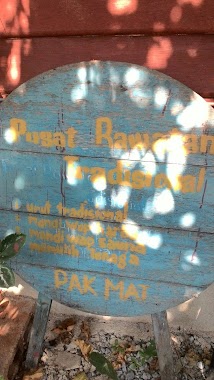
Pusat Rawatan Tradisional
12A, Jalan Buloh Kasap, Kampung Batu Lintang, Segamat
Doctor
read more
8.289 km
Klinik Segamat
15, Jalan Emas 9, Kampung Batu Hampar, Segamat
Doctor
read more
8.534 km
Klinik Utama
No. 42, Jalan Utama 2/7, Bandar Utama, Segamat, Segamat
Doctor
read more
9.834 km
TD Binary Stockist
No 5, Taman Sia Her Yam, Jalan Serindit, Segamat District
Doctor
read more
10.375 km
Shiema As Syifa Homeopathy Centre
No, Kampung Paya Pulai, 7, Jalan Kuning, Taman Pelangi, Segamat
Doctor
read more
11.072 km
杨氏医药针灸中心 Pusat Ubat Dan Rawatan Tabib Yong
78, Jalan Putra 2/23, Bandar Segamat Baru, Segamat
Doctor
read more
11.263 km
KLINIK SOON
Jalan Putra 2/23, Bandar Putra, Segamat
Doctor
read more
11.268 km
Tabib perubatan traditional china
26, Jalan Putra 2/23, Bandar Segamat Baru, Segamat
Doctor
read more
11.959 km
Kumpulan Perubatan Elektronik Segamat
31, Jalan Putra, Bandar Putra, Segamat
Doctor
read more
11.967 km
Pusat Rawatan Bekam Darul Na'im
31, Jalan Putra, Bandar Putra, Segamat
Doctor
read more
12.47 km
红牌脚底按摩
75, Jalan Tan Siew Fun, Bukit Siput, Segamat
Doctor
read more
12.526 km
TNB Distribution (Rumah Murah Bukit Siput)
83, Jalan Sentosa, Bukit Siput, Segamat
Doctor
read more
12.843 km
Segamah 抓耳虫
Taman Bukit Baru, Bukit Siput
Doctor
read more
📑
all categories
Accounting
Administrative area level 1
Administrative area level 2
Airport
Amusement park
Aquarium
Art gallery
Atm
Bakery
Bank
Bar
Beauty salon
Bicycle store
Book store
Bowling alley
Bus station
Cafe
Campground
Car dealer
Car rental
Car repair
Car wash
Casino
Cemetery
Church
City hall
Clothing store
Colloquial area
Convenience store
Courthouse
Dentist
Department store
Doctor
Electrician
Electronics store
Embassy
Establishment
Finance
Fire station
Florist
Food
Funeral home
Furniture store
Gas station
General contractor
Grocery or supermarket
Gym
Hair care
Hardware store
Health
Hindu Temple
Home goods store
Hospital
Insurance agency
Jewelry store
Laundry
Lawyer
Library
Light rail station
Liquor store
Local government office
Locality
Locksmith
Lodging
Meal delivery
Meal takeaway
Mosque
Movie rental
Movie theater
Moving company
Museum
Natural feature
Neighborhood
Night club
Painter
Park
Parking
Pet store
Pharmacy
Physiotherapist
Place of worship
Plumber
Point of interest
Police
Political
Post office
Premise
Real estate agency
Restaurant
Roofing contractor
Route
Rv park, camping
School
Shoe store
Shopping mall
Spa
Stadium
Storage
Store
Sublocality
Subpremise
Subway station
Supermarket
Taxi stand
Train station
Transit station
Travel agency
University
Veterinary care
Zoo
administrative area level 3
administrative area level 4
sublocality level 1
↑